
Terrapattern finds places that look the same using machine learning.
Terrapattern is a prototype for helping people quickly scan extremely large geographical areas for specific visual features. We are particularly keen to help people identify, characterize and track indicators which have not been detected or measured previously, and which have sociological, humanitarian, scientific, or cultural significance.
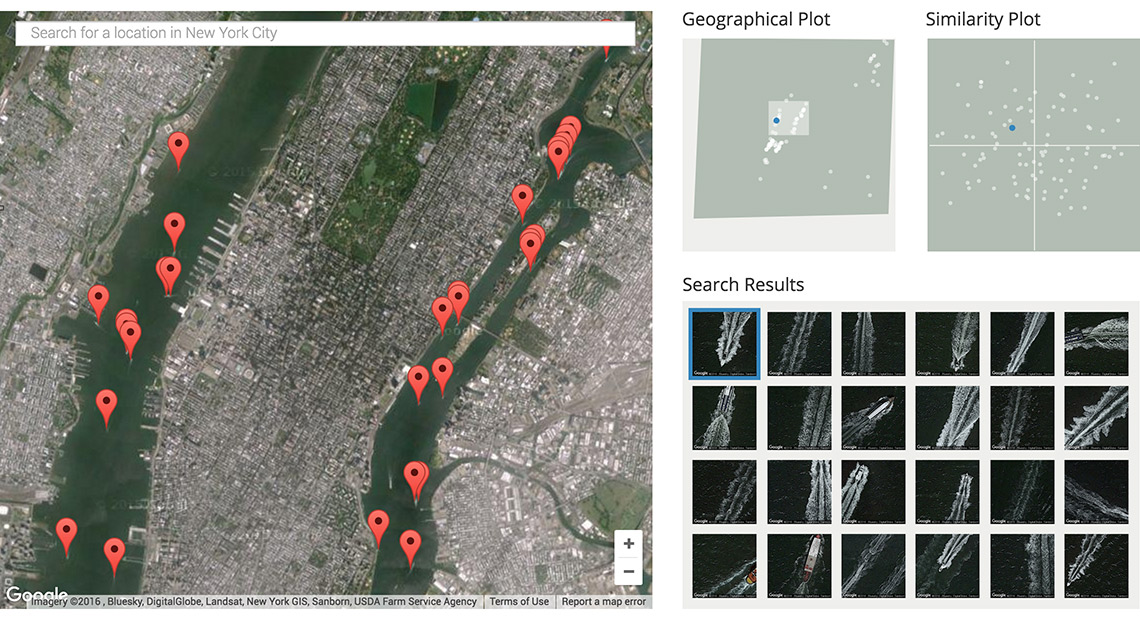
Terrapattern provides an open-ended interface for visual query-by-example. Simply click an interesting spot on Terrapattern's map, and it will find other locations that look similar. Our prototype is ideal for finding things that aren't usually indicated on maps. For best results, we recommend using a device with a large screen.
Terrapattern can identify things like:
...boat wakes in New York City rivers,

...shipping container yards in Manhattan,

...suburban cul-de-sacs near Pittsburgh,

...and much more!